Overview
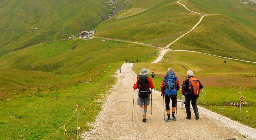
Chopta Chandrashila Deoriatal could be a window into Himalaya’s spring color quality. A well-loved trek for mountain goers of every kind, this trek prospers with blossoms, particularly rhododendrons red and pink, in summer time whereas winters square measure a hazy shade with enough scopes to own a ball in spilling snow. The full tour covers a swoop to the Chandrashila Peak, passing by the attractive Deoriatal lake facet, and release a gallery of beautiful snow peaks all the method. This 5-day set up is unmatched in nature’s beauty, exhilarating challenges, time-efficiency and convenience. The highlights of the trek vary from awing summit views to heat of the forest greens, piquing up interest’s altogether types of mountain lovers. You’ll be a nature money dealer, bird observation amateur, or a partisan with a dream of capturing the drama within the highlands, Chopt-Chandrashila-Deorital could be a trek for all and fails none.
The first massive stop on the trek comes with Deoriatal. Set at a decent height of seven, 800 feet, the lake is gripped with forests all around. At a brief distance ahead, the Chaukhamba formation glistens and also the reflection of its caught within the crystal-like waters of the lake. The impact is placing. The site is steeped in myths. As goes the story, the 5 pandava brothers from the sacred writing, once thirsty, had come back to the waters of Deoriatal and two-faced a check of knowledge. Habitation here the primary night beneath a star dusted sky makes the mellowest of recollections on a trek. Next informed the road of visual ecstasies square measure the in depth meadows that turn to snow fields on the thanks to Chopta. Collectively furthers up the path, nice peaks jump to view—Bandarppoonch, Kadar, and Chaukhamba to call some. These stellar options of Garhwal mountain range promise to urge a lot of elucidated from the celestial point of Chandrashila that the motivation isn’t lost and one goes on till the top of the summit stretch at the Tunganath temple.
Itinerary
- Pick Up Point- Haridwar Railway Station
- Pick up Time- 6:00 am
- Distance- 190 km
- Driving Time- 7 hour
- Altitude- 6,600 ft.
- Network Availability- Available till Sari
our tour guides can expect you at Haridwar train depot at 6:30 within the morning nowadays. You’ll be able to organize a long bus journey from city, reaching Haridwar within the morning or reach some of days earlier to the beginning day of the trek. Haridwar-Rishikesh by the Ganges River could be a renowned web site on the pilgrim path of Uttarakhand. You can pay it slow in Rishikesh immersing in cultural activities and journey sports within the stormy waters of Ganga. We will decide you up instead from Rishikesh furthermore.
From now to dress village could be a journey of 7-8 hours. Absorb the gorgeous scene of lower Garhwal mountain range because the drive turns uphill. The foremost picturesquely notable stop on the means are at Devaprayag- a city marking the attractive confluence of Alakananda and Bhagirathi. The stream can keep you company throughout, reaching you at dress by 6:00 within the evening. The village could be a pretty image composed of very little homes sketched across a mountain scenery and lined with inexperienced patches of agricultural fields. If you’re missing any minor requisite for the journey ahead, visit the market space in dress, simply would possibly realize one thing useful!
- Distance- 3 km
- Trekking Time- 1 hour
- Altitude- 7,800 ft.
- Water source-None.
The trek on the primary day is simple with mixed ascent and descent. A well-defined rocky path can show you to the top, from wherever the Chandrashila summit is clearly visible and also the Tunganath temple may be a speck of color. When this time, it’s a steep uphill bend on the ridge back of the mountain. Prepare for an acutely grueling climb, giving you the primary style of challenge. Soon, you’ll reach the Forest Department built resting stop. Clocked timely by your Trek Leader, you’ll be able to afford a twenty minutes break here. A superb read the approach of the mountain fall waits here.
Post-rest, the path can bend through a forest of rhododendrons. Spring treks here within the crimson shadow shrub blossoms create it unforgettable quite ever. We have a tendency to go steady up. At 7, 434 ft. village localities vanish from sight. Nearly twenty minutes from this time, we’ll be standing with the waters of Deoriatal lustrous down an unsteady light slope.
A grand panorama of Chaukhamba massifs is disclosed within the background of the lake. It’ll be mid-noon by the time you reach the spot. Look ahead to the morning once the inclemency lifts and a diamond-crushed daylight elucidate the outlines of Chaukhamba, creating for the final word placing frame. Having the whole day to yourself, explore the deep nooks of the forests lying out around, a paradise for bird-watchers and nature lovers. Hot lunch on at the present time are served on reaching our shore camp in Deorital.
Try Other Relevant Tools Plagiarism Checker Grammar Checker Spell Checker
- Distance- 16 km
- Trekking Time- 7-8 hours
- Altitude at Chopta-8,700 ft.
- Water source- A ground water source before entering Rohini Bugyal. Waterfalls on the second half of the trail.
Today’s path can inform you a lot of with the Chaukhamba formation and Mount Kadar summit, rising closely as you method. Rhododendron and maples eclipse the forest path, spreading a cool and rejuvenating atmosphere. In these thickets you may realize 2 outstanding sorts of rhododendrons—red and pink, the concentration of them thickens as you progress pass the primary forest stretch.
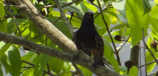
The path is wet with very little shrines that stand come in the greenness by the red and yellow flags tied on them. Once crossing a clearing within the forest lined with scarlet blossoms, we tend to area unit directly ushered up AN ascending path towards Rohgini Bugyal and Chopta. The ascending path offers thanks to level land and a few leeway within the rigorous uphill hike. A resplendent read of the Chandrashila awaits on the opposite aspect of the forest margin. Once the level-land, you may got to get in the forest currently characterized with recent oaks and maple besides the rhododendrons. This forms a part of the Kedarnath Sanctuary, and with some luck, trekkers will spot red fox and different little wild things.
More twenty five minutes of trekking within the Kedarnath Sanctuary path and you may reach the Bhagdwal temple. This can be a junction purpose for 3 trek routes. One connects to saree village, another towards Ukhimath, and also the central one raining to the meadows of Rohini Bugyal. On this line, Chandrashila and flanked by the connected Kala Parvat Peak gain prominence. You’ll be able to realize the method bending from here to Bisuri Tal Lake and a tiny low lake named Nandikund, located at the bottom of Kala Parvat. More down as you progress, a silvery streamlet returning from Chandrashila meets your method. Here, you’ll be able to fill your water provides and go taking a tiny low picket bridge on the stream.
A little high, the meadows begin. Here, you may realize a cluster of huts. Shepards from native villages come back here to graze their ethereal mammal. Shortly from here, you may realize a road head at the margin of a jungle path. During this space within the locality of Chopta village, we’ve got our land site at a clearing within the forests.
- Buniyakund to Chopta (Drive 3km)
- Chopta to Tungnath, Chandrashilla Summit and back (Trek 8km)
- Trekking Time- 7-8 hour
- Altitude- 13,100 ft.
- Water Source- None
- View:
Mountains of Garhwal and Kumaon- Nanda Devi, Trishul, Nandaghunti, Kamet, Dronagiri, Chaukhamba, Kedar dome, Thalaysagar, Gangotri ranges, Jahanukut etc.
we start the hike these days early morning. Beginning within the wee hours of dark can allow us to have a gorgeous sunrise expertise from Tunganath high. The trek runs on a well-defined concrete-bound path from Chopta to the temple. Today, the hike are fraught with steep ascension challenges with sharp turns to cross by. There’ll be different shrines on the method, of that a specific temple with a flagpole is notable. This one comes once the tenth bend of the road and marks the gap of a splendid read of Chandrashila up ahead. From here, you may conjointly get a transparent vision of a connecting peak to Chandrashila. This one is known as Ravanshila.
In the winters, you may notice snow from here. The eleventh bend marks the entry to Tunganath on top of that the luxurious Chandrashila peak towers at twelve, 083 ft. The route to the height bends from behind the temple advanced. watch out for thick snow on this summit stretch once Dec until the tip of Apr. Crampons associated gaiters square measure extremely suggested for the snow climb and your trek lead is anticipated high create the trail through the duvet of snow sludge with the assistance of an ax.
At the tip of a steep and arduous climb, the summit are reached with a 360 degree read of the Garhwal and Kumaon mountains welcomingly lying ahead. Notable peaks during this panorama of grandeur are—Nanda Devi, Trishul, Nandaghunti, Dronagiri, Chaukhamba, and Kedar. Glimpses of the Thalaysagar and Gangotri ranges too might be created out at the sides.
The downhill journey is comparatively less time overwhelming and electric sander. It’ll take you concerning three hours to alight to the Baniyakund campground.
- Drop off Point-Haridwar Railway station
- Distance- 210 km
- Time- 7 hour; destination to be reached around 6:30 pm
A ride back from the Chopta road head to Haridwar is scheduled for day five. Once this seven hour journey filled with mellow reminisces of the hills, you may be reaching Haridwar within the evening. Associate long journey to Old Delhi can hopefully estimate best.
How to Reach
By Air: –
Jolly Grant landing field is that the landing field serving Dehradun, settled concerning forty eight kilometer from the Haridwar. There’s a daily flight from Old Delhi for Dehradun, reach Haridwar at some point early if returning by flight.
By Train: –
An excellent rail network connects Haridwar to different necessary cities like Old Delhi, Mussoorie, Mumbai, Varanasi, Luck now, and Kolkata.
From Old Delhi -DDN NZM AC categorical (2205)
From Kolkata- Doon categorical (13009)
From Mumbai- Dehradun categorical (19019)
From Chennai- Dehradun categorical (12687)
By Bus: –
There is regular utility from Old Delhi to Haridwar, from Old Delhi ISBT Kashmere Gate.
We would counsel you to require solely government buses from ISBT Kashmere Gate. Non-public buses ply from outside ISBT and that they aren’t trust goodness.
Usually buses drop you at Haridwar bus depot. From there you’ve got to return to Haridwar terminus
TTH’s Tata wrestling or similar vehicles can pick-up you from Haridwar terminus at 6:00am.
Trek Info
Region: Uttarakhand
Duration: 5 Days
Grade: Easy
Max Altitude: 13,100 Ft.
Trekking Km: 30 Kms.
Trail Type: A cross over trail through forest
Rail head: Haridwar is the nearest rail head to the base camp
Air Port: jolly grant airport Dehradun
Base Camp: Sari Village (7 hrs. drive from Haridwar)
Best Season: Round the year except monsoon. More snow in the winter months until April.
Snow: Round the year except monsoon and post monsoon.
Batch Size: 15 trekkers including Male and female.
Services from: Haridwar to Haridwar
Food: Meals while on trek (Veg + Egg)
Stay: Guest house, Camping
Fitness:
Get yourself fit/Fitness Parameter
| Back pack & rain cover | (50 – 60 liter) with comfortable shoulder straps |
| Day pack + rain cover | 20 – 30 liter (If hire a mule or porter) |
| Walking stick | Advisable (At least one) |
| Head torch | 1 Nos. |
| Water bottle/Hydration pack | 2 bottles of one liter each |
| People who use hydration pack | |
| 1 hydration pack and 1 bottle of one liter | |
| Carry at least one thermos flask | |
| Snacks | Energy bars, dry fruits, electoral/ors |
| Personal Medical Kit | Consult your doctor |
| T-shirts | 2 Full sleeves (Non-cotton) |
| Fleece jacket | 1 Nos. (Alternative: a woolen sweater) |
| Wind & waterproof (jacket & pant) | 1 Pair |
| Thermal inners (upper and lower) | 1 Pair |
| Trek pants | 2 Synthetic (avoid shorts, fitting denims, capris) |
| Poncho | 1 Nos. |
| Sunscreen cream | Hand sanitizer |
| Moisturizer | Antibacterial powder |
| Toilet Paper & wipes | Toothbrush and toothpaste |
| Lip balm | Quick dry towel |
| Neck-gaiters | 1 Nos. |
| Sunglasses | Dark with side cover, it should be U/V protected. |
| People who wear spectacles- | |
| (A)- Use contact lenses. (Not for Chadar trek) | |
| (B)- Photo chromatic glasses. | |
| Neck-gaiters | 1 Nos. |
| Sunglasses | Dark with side cover, it should be U/V protected. |
| People who wear spectacles- | |
| (A)- Use contact lenses. (Not for Chadar trek) | |
| (B)- Photo chromatic glasses. |
Things to take/Essential things to take
Cost Terms
Inclusions: –
1. Accommodation. (Guest house, Home stay, Camping)
2. Meals while on trek (Veg. + Egg)
3. Trek equipment’s: Sleeping bag, mattress, tent (twin sharing), kitchen & dinning tent, utensils and crampon (if required)
4. All necessary permits and entry fees
5. First aid medical kits and oxygen cylinder
6. Mountaineering qualified & professional trek Leader, guide, cook and Support staff
7. Porters/mules to carry central equipment
8. Transport Haridwar to Sari and Chopta to Haridwar
Exclusions
1. Any kind of personal expenses
2. Food during the transit
3. Insurance
4. Any kind of emergency evacuation charges
5. Mules or porter to carry personal backpack
6. Anything not specifically mentioned under the head
Note: Normally TTH expect to carry your personal luggage on your own, if you wish to offload your backpack, you can give it to Mule.
Charges of offloading backpack:-
INR 700/- if you make an online payment, 10 days in advance
INR 900/- if you inform us after reaching Sari village
The backpack cannot weigh more than 11 kgs. Backpack should have waterproof cover. Suitcases/strolleys/ bags will not be allowed.
Paying the Trek/ Adventure activity fee:
The fee is paid by on-line transfer/check deposit/ demand draft. Instruction for payment are going to be forwarded at the side of your confirmation email. Once your transfer is completed, please e-mail U.S. a confirmation mail along with your transfer details, so we are able to follow up your reservation with efficiency.
Map & getting there/Map
High Altitude Treks
Risk and Response: – A high altitude trek necessitate an adventuresome perspective, however embarking on associate degree adventuresome trip while not hard the risks is utter stupidity. That’s why we’ve listed a number of risks and therefore the response planned by TTH to minimize or address the risks within the absolute best manner.
Altitude: – Before you begin the trek, it’s necessary to know the implications of high altitude on your body. Remember of symptoms of AMS (Acute Mountain Sickness) like gentle headache, nausea and general discomfort.
If you’re feeling any of those symptoms, inform the trek leader on priority and follow his directions. Each camping area has as stretcher, absolutely equipped aid kit, gas cylinders to deal with the case.
Weather: – Weather is unpredictable within the range. Though we have a tendency to be invariably observant regarding the ever-changing weather, nobody will guarantee a snow, rain or Sun. Do perceive that your security is of utmost importance to U.S. and that we won’t proceed to any extent further from the camping area if the weather isn’t favorable.
The decision of the Trek Leaders and Guides to proceed or sit up for the weather to induce higher are going to be final.
Injuries usually, whereas trekking over troublesome terrains, you may have minor injuries like leg sprain, bruises etc. Serious injuries like fractures or major cuts are terribly rare.
Response: All our Trek Leaders are certified geographical area aid responders. They trained to handle emergencies and may tackle minor injuries with a well-equipped aid kit. Just in case of great injuries, the patient is carried on a stretcher to the closest road-head and is LED to nearest medical center.
Risk: Lack of communication devices within the remote areas of the range, mobile networks don’t reach. On a trek, one is discontinue from the globe of calls, SMS or watsapps.
Safety
Cancelation policy/Terms & Cancelation Policy
When to book:
its wise build you’re booking a minimum of 2 months beforehand. However, if you wish an honest deal on your domestic/international flight, we tend to suggest organizing your go to vacation at least 5 months beforehand.
In the event of cancellation of trek/adventure activity services thanks to any avertable / ineluctable reasons we tend to should be notified of an equivalent in writing. Cancellation charges are going to be effective from the date we tend to receive recommendation in writing, and cancellation charges would be as follows: –
Cancellations before twenty four days from the beginning of the trek
Watsapps Book the other trek until one year or get ninety fifth refund
Cancellations prior to 24 days from the start of the trek
Book the other trek until one year or get ninety fifth refund
(Note: If the trek charges area unit a lot of, the balance must be paid by the trekker)
Cancellation between 24 days and 14 days to the start of the trek
Cancellation between twenty four days and fourteen days to the beginning of the trek
Watsapps opt to choose an equivalent trek, with the other batch, until year or get seventieth refund
Cancellation between 14 days and 10 days to the start of the trek
Prolong an equivalent trek, within the same season, with the other batch or get five hundredth refund.
Cancellation less than 10 days to the start of the trek
Transfer your trek (same trek, same batch) to your friend. No money refund.
Note:-
1) – Change of trek batch is dependent on the availability of seats in the batch.
2) – In case of transferring a trek to a friend, he/she should satisfy all the mandatory requirements put forward by TTH.
3) – TTH holds the right to change/cancel the policies, without prior notice.
Let our experts suggest a trek for you- Bhrigu lake trek, Valley of flowers, Tarsar marsar lake trek, nag tibba trek, binser trek, Kareri lake trek etc.